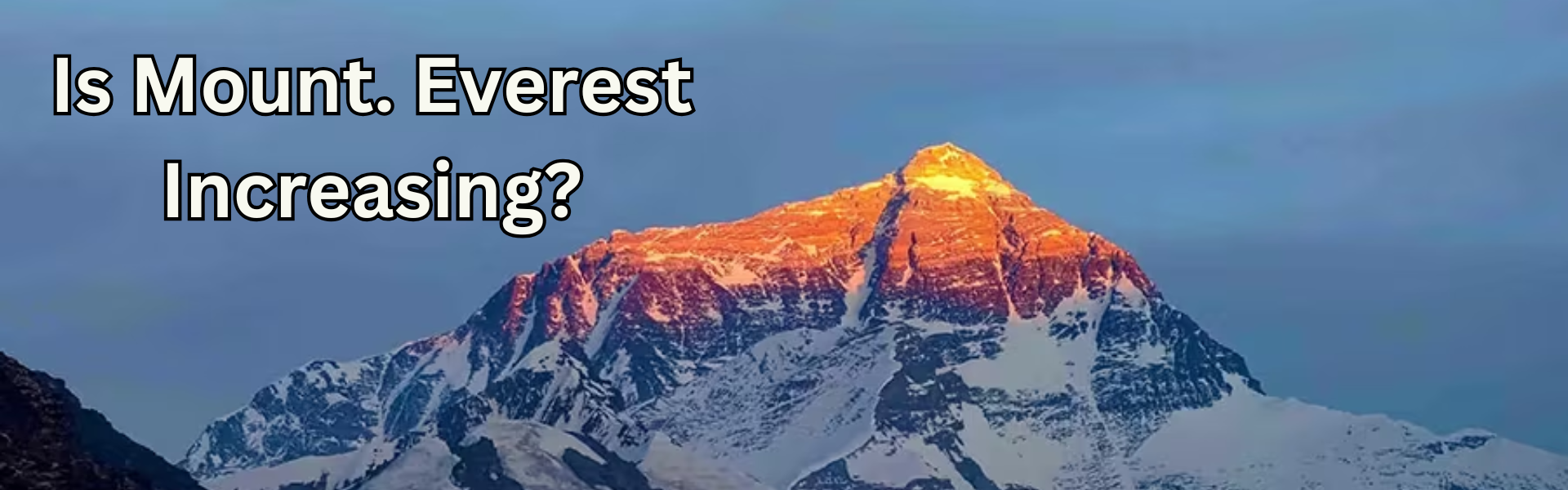
Mount Everest is regarded as the world’s tallest mountain. The summit of Everest is considered the highest point in the world. It is called Sagarmatha in Nepali and Chomolungma in Tibetan. The mountain rises above the Himalayas. The height of Mount Everest has changed over the period of time. This happens because of technology, tectonic movements, and earthquakes.
The current official height of Mount Everest is 8,848.86 meters (29,031.7 feet). Nepal and China announced this measure together in December 2020. It is the most accurate measurement so far.
The History of Measuring Everest
People have measured Everest since the 19th century. During the Great Trigonometrical Survey of India, British surveyors aimed to map the region. They wanted to measure the height of the Earth’s highest peaks.
In 1856, surveyor Sir George Everest, after whom the mountain is named, and his team measured a peak then called Peak XV. They used triangulation and barometric measurements. They estimated the height to be 8,840 meters (29,002 feet). This was considered very close to modern measurements. It made Everest the highest known point on Earth at that time.
Technological improvements took more than 100 years to increase accuracy.

US$ 1390
Factors That Cause Height Changes
Everest’s height is not fixed. It changes slightly over time. Several factors cause these changes:
Tectonic Plate Movements
Mount Everest is located where the Indian Plate and the Eurasian Plate meet. These plates push against each other. The movement of the tectonic plates has brought changes in the height of mount Everest. The movement in the plates has caused the Himalayas to grow the height about 4–5 millimeters per year. The mountain gets slightly taller each year. The changes in the height of mount Everest takes much years to be noticable
Erosion and Glaciation
The movement of wind and ice wears down the mountain. Snow and glaciers can change the height of the top over time.
Earthquakes
Earthquakes can change the height of Everest quickly. The 2015 Nepal earthquake was strong. It caused experts to question if Everest’s height had decreased. Nepal then measured the mountain again to find out.
Methods to Measure Everest Over Time
Measuring methods have changed. The earliest methods used simple tools. Later, new technology improved accuracy.
Triangulation (19th Century)
Surveyors used angles and distances on the ground. They used basic trigonometry. This method was quite accurate for its time.
Barometers and Theodolites (20th Century)
Surveyors used the theodolite to measure angles more precisely. Barometers helped determine altitude. The weather could affect these measurements.
GPS and Satellite Data (21st Century)
Genuine measurements now use GPS devices and satellite technology. Devices on the summit send data. This helps calculate the exact height. Radar and LiDAR are used to measure snow and ice thickness at the top.
Official Height in 2020: 8,848.86 meters
Before 2020, Nepal used a 1955 measurement of 8,848 meters (29,028 feet). China’s 2005 measurement was 8,844.43 meters (29,017 feet). These values measured only the rock, not the snow.
Both countries conducted new surveys with advanced equipment. They used GPS and radar technology.
Nepal’s 2019 Measurement
In 2019, Nepal’s survey team measured Everest for the first time. They used GPS on the summit and ground radar to measure the depth of snow and ice.
China’s 2020 Measurement
In 2020, China measured Everest from the north side. They used BeiDou satellite technology.
The Joint Announcement
In December 2020, Nepal and China announced the height. They said it was 8,848.86 meters (29,031.7 feet). This includes the mountain’s rock and snow cap. It is the most complete measurement to date.
Everest’s Height Compared to Other Peaks
Even with modern measurements, Everest is the tallest mountain. Some other mountains are close in height, depending on how height is measured:
- K2 (8,611 meters / 28,251 feet) – Located in Pakistan’s Karakoram Range, it is the second-tallest mountain in the world.
- Kangchenjunga (8,586 meters / 28,169 feet) – On the border between Nepal and India, it was once thought to be the highest mountain before Everest’s height was confirmed.
- Mauna Kea (10,210 meters / 33,500 feet) – In Hawaii, this volcano is technically taller than Everest if measured from its base under the ocean. Its summit is only 4,207 meters above sea level.
So, Everest is still the highest mountain above sea level. It is the highest point on Earth.
Measuring Height
Everest is not the farthest point from Earth’s center. Earth is slightly flattened at the poles and bulges at the equator. Because of this, the Chimborazo Volcano in Ecuador is farther from Earth’s center than Everest, even though it is shorter in height.
Despite this, Everest is the highest above sea level. This is the standard way to measure mountains globally.
Why Everest’s Height Matters
Everest’s height has different meanings. It has scientific, cultural, and symbolic importance:
- Science – It shows tectonic activity and helps monitor climate change and glacier melting in the Himalayas.
- Nepal and China – The mountain is important for national pride and identity.
- Climbers and explorers – It is the ultimate challenge to reach the top, called “the top of the world.”
Many climbers and hikers go to Everest Base Camp each year. They are inspired by the mountain’s size and significance in human history.
The Future of Measuring Everest
Technology will improve how we measure Everest. Scientists are exploring satellite interferometry and laser altimetry to measure changes in Everest’s height from space.
Climate change is another concern. Rising temperatures may affect the snow and ice on Everest, changing its height slightly. Regular measurements will track these changes and improve understanding of how the Himalayas respond to environmental changes.
Conclusion
How tall is Everest? The current measurement is 8,848.86 meters (29,031.7 feet) from land level to everest base camp to the top. This number has come from many surveys, science, and exploration. Everest’s true importance goes beyond height. It shows perseverance, unity, and the human effort to reach higher.
From early surveyors in India to modern satellite scientists, each generation has asked the same question: How high can we go?
Mount Everest remains a strong symbol. It reminds us that there is always another goal, in nature and in life.